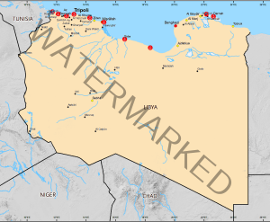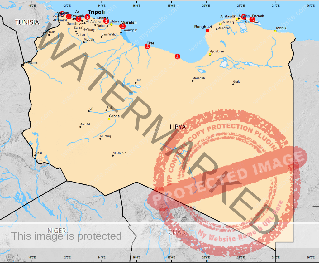
Libya (Arabic: ليبيا Lībyā), officially the State of Libya, is a country in the Maghreb region of North Africa bordered by the Mediterranean Sea to the north, Egypt to the east, Sudan to the southeast, Chad and Niger to the south, and Algeria and Tunisia to the west. The three traditional parts of the country are Tripolitania, Fezzan and Cyrenaica. With an area of almost 1.8 million square kilometres (700,000 sq mi), Libya is the 17th largest country in the world.
The largest city and capital, Tripoli, is home to 1.7 million of Libya’s 6.4 million people. In 2009 Libya had the highest HDI in Africa and the fifth highest GDP (PPP) per capita in Africa, behind Equatorial Guinea, Seychelles, Gabon, and Botswana. Libya has the 10th-largest proven oil reserves of any country in the world and the 17th-highest petroleum production.
Geography
Libya extends over 1,759,540 square kilometres (679,362 sq mi), making it the 17th largest nation in the world by size. Libya is somewhat smaller than Indonesia in land area, and roughly the size of the US state of Alaska. It is bound to the north by the Mediterranean Sea, the west by Tunisia and Algeria, the southwest by Niger, the south by Chad and Sudan and to the east by Egypt. Libya lies between latitudes 19° and 34°N, and longitudes 9° and 26°E.
At 1,770 kilometres (1,100 mi), Libya’s coastline is the longest of any African country bordering the Mediterranean. The portion of the Mediterranean Sea north of Libya is often called the Libyan Sea. The climate is mostly dry and desertlike in nature. However, the northern regions enjoy a milder Mediterranean climate.
Natural hazards come in the form of hot, dry, dust-laden sirocco (known in Libya as the gibli). This is a southern wind blowing from one to four days in spring and autumn. There are also dust storms and sandstorms. Oases can also be found scattered throughout Libya, the most important of which are Ghadames and Kufra.
Libyan Desert
The Libyan Desert, which covers much of Libya, is one of the most arid places on earth. In places, decades may pass without rain, and even in the highlands rainfall seldom happens, once every 5–10 years. At Uweinat, as of 2006 the last recorded rainfall was in September 1998. There is a large depression, the Qattara Depression, just south of the northernmost scarp, with Siwa Oasis at its western extremity. The depression continues in a shallower form west, to the oases of Jaghbub and Jalu.
Likewise, the temperature in the Libyan desert can be extreme; on 13 September 1922 the town of ‘Aziziya, which is located southwest of Tripoli, recorded an air temperature of 57.8 °C (136.0 °F), considered to be a world record. In September 2012, however, the world record figure of 57.8°C was overturned by the World Meteorological Organization.
There are a few scattered uninhabited small oases, usually linked to the major depressions, where water can be found by digging to a few feet in depth. In the west there is a widely dispersed group of oases in unconnected shallow depressions, the Kufra group, consisting of Tazerbo, Rebianae and Kufra. Aside from the scarps, the general flatness is only interrupted by a series of plateaus and massifs near the centre of the Libyan Desert, around the convergence of the Egyptian-Sudanese-Libyan borders.
Slightly further to the south are the massifs of Arkenu, Uweinat and Kissu. These granite mountains are ancient, having formed long before the sandstones surrounding them. Arkenu and Western Uweinat are ring complexes very similar to those in the Aïr Mountains. Eastern Uweinat (the highest point in the Libyan Desert) is a raised sandstone plateau adjacent to the granite part further west. The plain to the north of Uweinat is dotted with eroded volcanic features. With the discovery of oil in the 1950s also came the discovery of a massive aquifer underneath much of the country. The water in this aquifer pre-dates the last ice ages and the Sahara desert itself. This area also contains the Arkenu structures, which have been hypothesized to be double impact craters.